Our story
Built from the field up
GeoImaging Systems was founded in 2022 by Dave Heicher — a geologist with over two decades of HRSC experience across roughly 30 states and three years managing investigations in Australia. After years in the field, he saw the same problem everywhere: project managers were waiting hours or days for data that should be available in minutes. GeoImaging was built to fix that.
Today the company is a small, highly experienced team with over 50 years of combined HRSC experience. We work alongside environmental consultants, engineering firms, and regulatory agencies — bringing the data side so they can focus on making decisions.
Dave Heicher
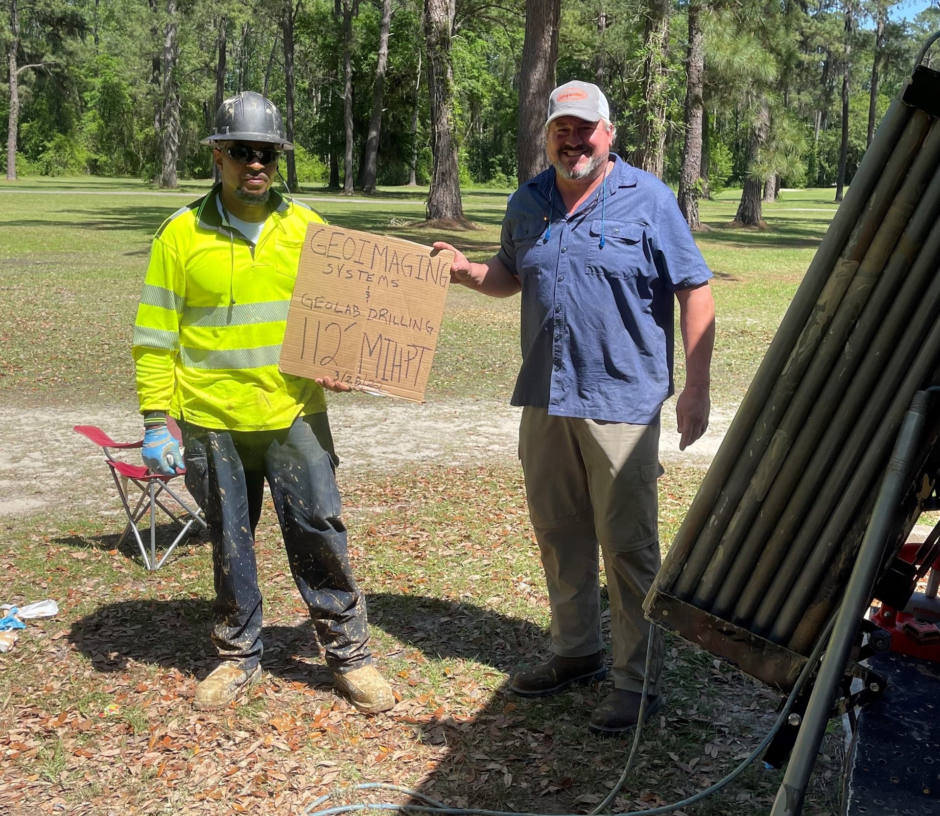
Celebrating a 112-foot MIHPT push — the "100' Club"
Our team
Meet the team
Every member of our team operates HRSC equipment in the field. We're hands-on from mobilization to final deliverable.
A geologist with over 30 years in the environmental industry, Dave has spent more than two decades operating HRSC probes and managing complex site characterization investigations. His career spans environmental consulting, field operations, and technical leadership across two continents — including nearly three years managing HRSC operations throughout Australia and seven years as Southeast Regional Manager for another national HRSC provider.
An engineer with nearly three decades of hands-on experience with HRSC, direct push, and cone penetrometer technologies. Before joining GeoImaging, Kevin owned and operated an environmental field services company for 14 years and served as Director of Southeast and Gulf Coast operations for another national HRSC provider.
A geologist with a background in environmental consulting, Griffin operates HRSC equipment and leads the development of GeoImaging's real-time data platform and GIS mapping capabilities. Before joining GeoImaging, he gained diverse field experience at one of the world's largest environmental consulting firms.
Anytime, Anywhere
Greenville, SC & Atlanta, GA
Based in Greenville, South Carolina and Atlanta, Georgia, GeoImaging is available nationwide and internationally. If you have a site that needs characterization, we'll travel to it — including difficult-access locations and environments other providers turn down.
Get in touchReady to work with us?
Whether you need help planning an investigation or want a proposal for an upcoming project, we're here to talk.