Our capabilities
Three pillars of
subsurface intelligence
From field-deployed HRSC logging tools to interactive 3D contamination models and underground utility mapping — we provide the complete picture.
Primary service
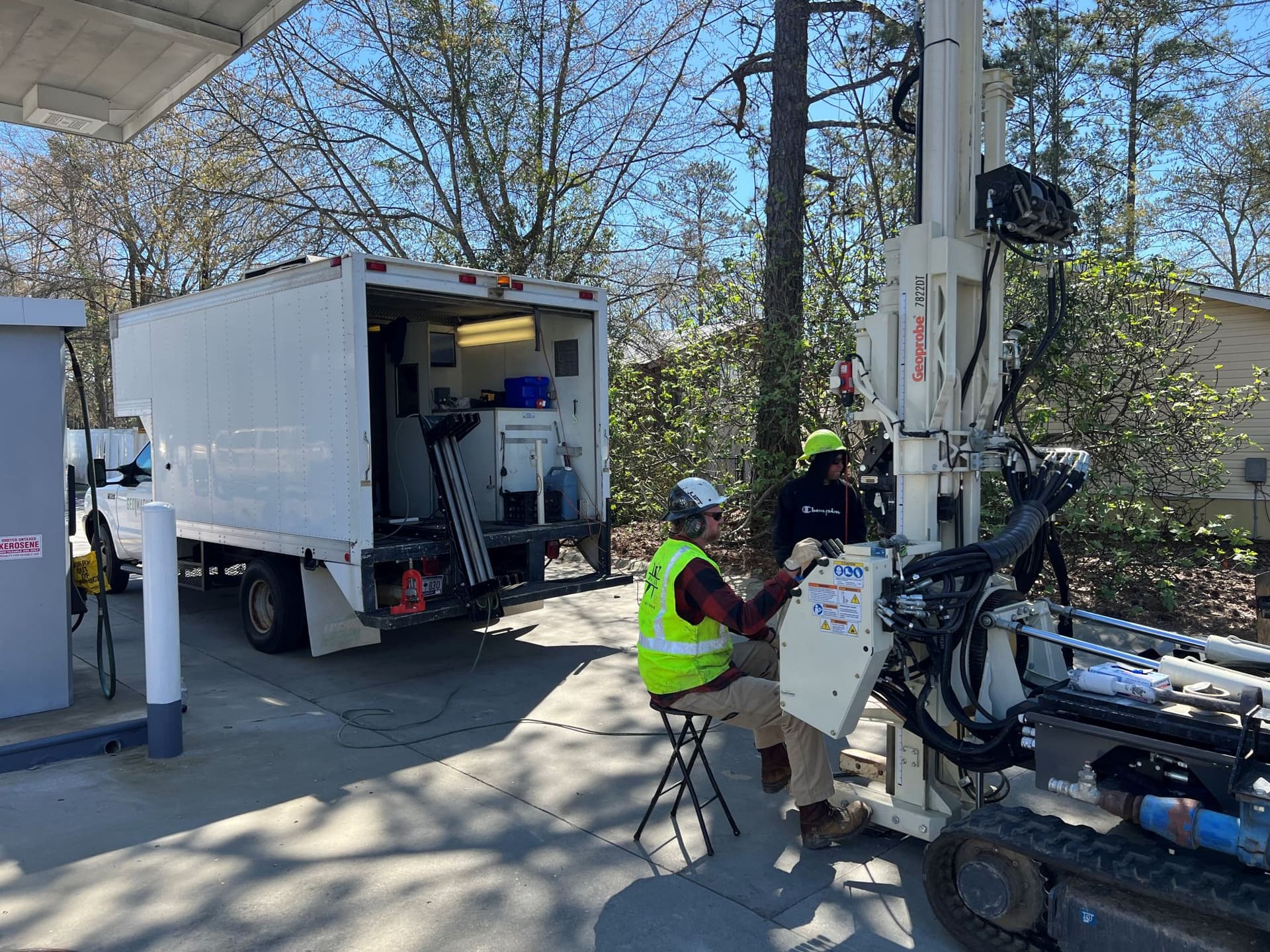
HRSC Investigations
High-Resolution Site Characterization using HRSC logging tools. Four primary HRSC logging tools for a wide range of site conditions and investigation objectives. Data 20 times per foot, delivered in real time.
Key differentiator
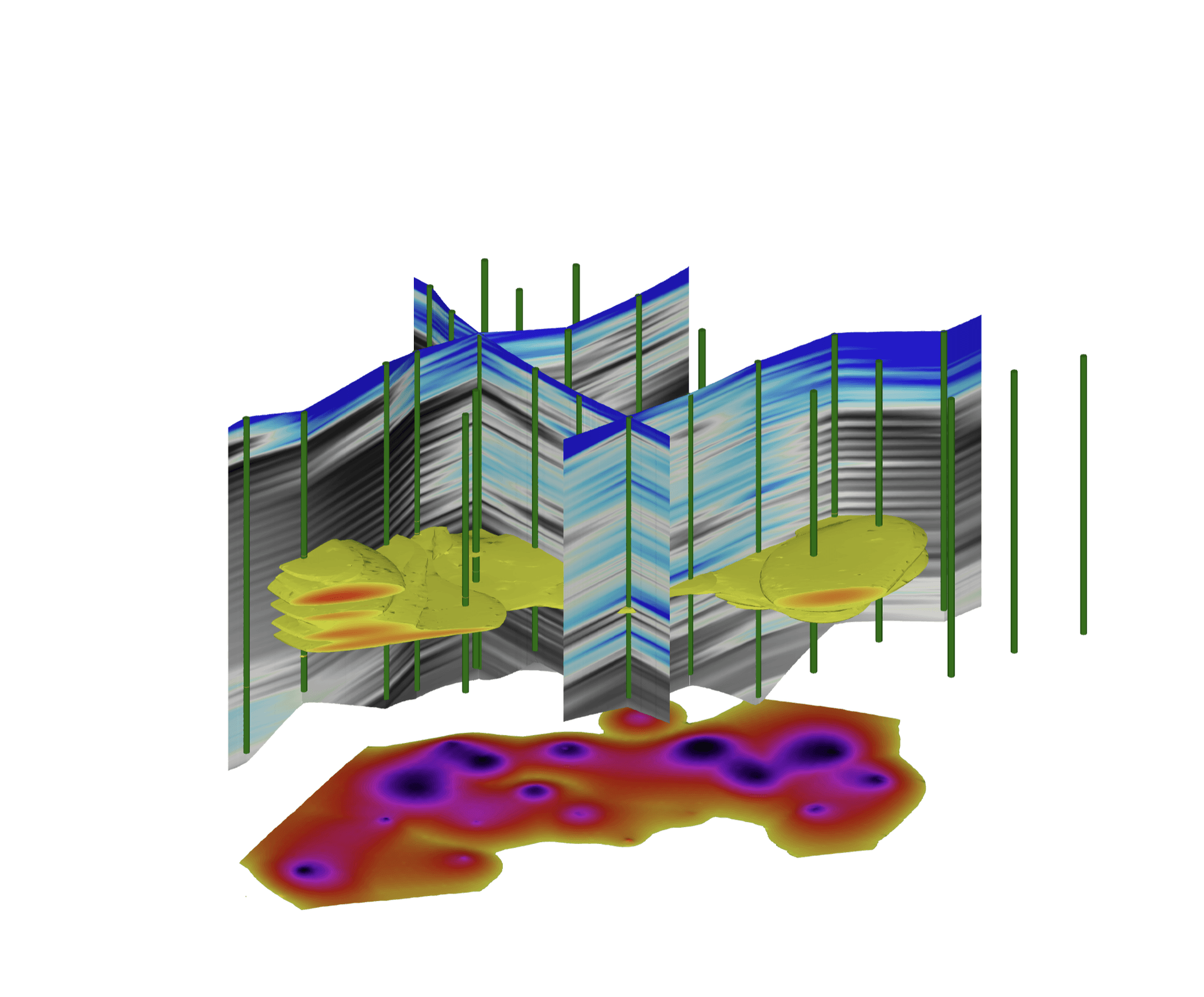
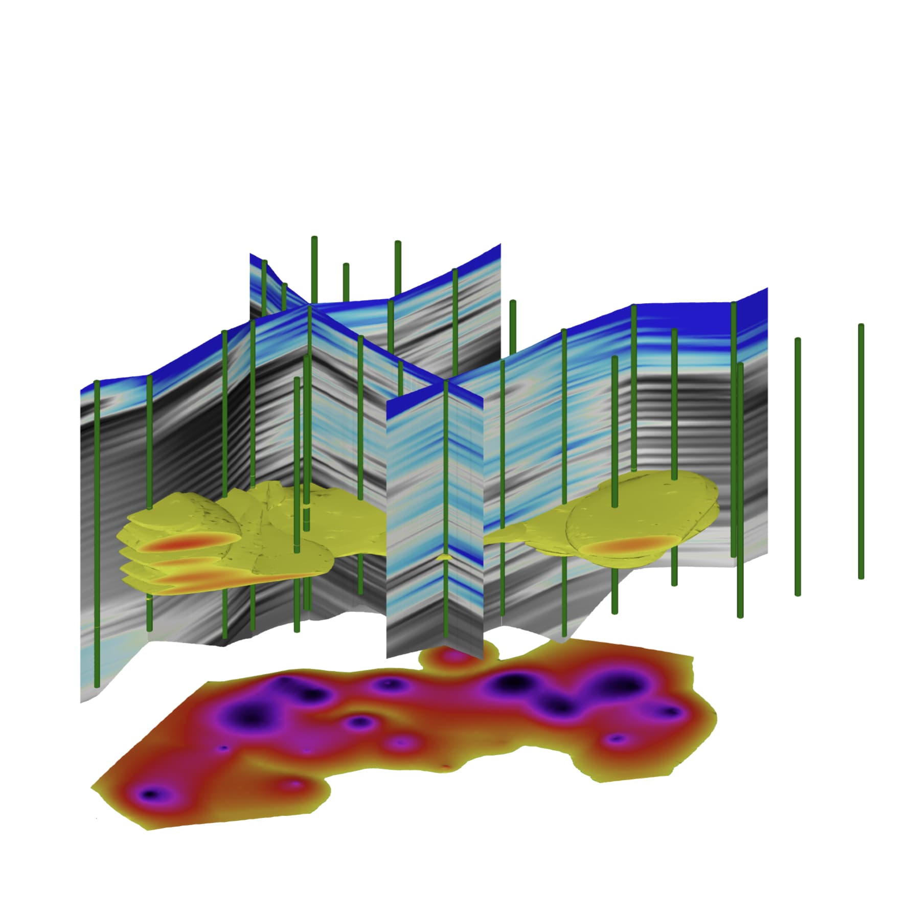
2D/3D Subsurface Modeling
We transform raw HRSC data into interactive 3D contamination models, lithology cross-sections, and plan-view maps using C Tech Development Corporation's Earth Volumetric Studio (EVS).
Interactive 3D contamination plume rendering
Lithology layers and geological cross-sections
Plan-view maps with borehole data overlays
Deliverables: interactive models, PDF reports, GIS exports
New service
Utility Locating
Underground utility detection and mapping using ground-penetrating radar and electromagnetic locating technology. Pre-construction clearance, SUE investigations, and comprehensive utility mapping.
Pinpoint GPR
Ground-penetrating radar
Vivax vLoc3
EM utility locator
2D Utility Maps
Plan-view deliverables
3D Utility Models
Subsurface infrastructure
Included with every project
Real-time client dashboard
Every HRSC investigation includes access to our real-time dashboard with interactive maps, log viewer, live video, and file delivery.
Explore the platformNot sure which tool you need?
Our team will recommend the right probe configuration and investigation approach based on your site conditions and target compounds.